Akademik ve Bilimsel Çalışmalarımız
Geophysical and UAV Surveys on Konya Karahöyük (Central Anatolia, Türkiye)
Abstract
15th International Conference on Archaeological Prospection (ICAP2023), Germany
İnci Nurgül Özdoğru, Gonca Dardeniz, Orkan Özcan, Fırat Yiğit, Serkan Özçelik, 2023
The archeological site of Konya-Karahöyük is located in the Konya plain of central Anatolia, Türkiye. Situated almost 8 km southeast of modern Konya, the site is at the crossroads from Syro-Mesopotamia to the Aegean (Alp, 1994). The archaeological material collection collected from the site dates to the 3rd-2nd millennia BC and displays Anatolian, Syrian, and Aegean influences confirming it as a dynamic hub of the Bronze Age.
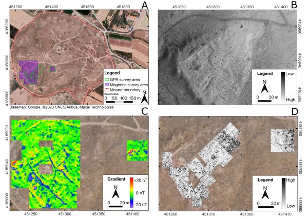
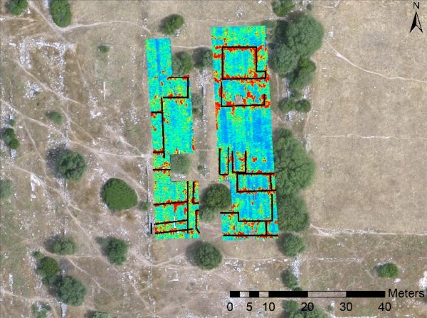
The mound of Konya-Karahöyük covers an area of 33 ha. With its lower town, which is heavily filled with alluvial deposits, the site spans almost 100 ha. Previous excavations at the site (from 1953 to 1994 with breaks) yielded remains of monumental architecture, yet, there is a lack of a systematic understanding of the architectural patterns. Excavations reinitiated at the site in 2022 aim to expose architectural remains of the upper and lower towns as well as to investigate the expansion of the site via using interdisciplinary methodologies. Thus, in the first season of the new round of excavations, a combined methodology of ground penetrating radar (GPR), magnetic prospection, and UAV including thermal imaging was applied systematically to unfold the architectural layout of this multilayered archaeological site. The results of this combined methodology, applied only at a small section of the mound, yielded promising results to detect architectural remains made of mudbrick and stone.
The fieldwork involved applying a combination of newly acquired aerial and geophysical survey data that include GPR and magnetic methods. The GPR used was GSSI UtilityScan with 350 HS central frequency, and the magnetometer was Geometrics G-858 MagMapper cesium vapor magnetometer. The profile spacing was 0.25 m for GPR and 0.5 m for the geomagnetic survey.
The mound rises 19 meters (m) above sea level, and it shows varying elevations at different parts due to archaeological as well as alluvial accumulation. Considering the complex morphology of the mound, the magnetic survey was favored for the detection of mudbrick and stone architecture. GPR was used in areas where the method is applicable morphologically and is comparable to magnetic survey results. Approximately an area of 4400 m2 was covered by GPR with a selected penetration depth of 3 m. Magnetics was applied approximately to 1.2 ha. The duration of data collection was two weeks. For the process of the GPR and magnetic datasets, ReflexW and MagPick software were used respectively.
GPR (Ground Penetratıng Radar) Survey At Tanır-Yassıhöyük; Southeast, Türkiye
Abstract
ILP Sedimentary Basins & GEOSCIENCE 2022, Romania
Yigit,F., Özçelik, S., Baştürk,E., 2022
Tanır Yassıhöyük is located near Bozyer Village approximately 20 km north of Afşin district of Kahramanmaraş Province and 4 km south of Tanır district. The mound is laid on a rocky area just on the west side of Hurman Stream. It can be considered within the scope of large sized mounds with 260 x 160 m. extent and 17 m in height. The upper part of the mound, which was probably surrounded by a wall, has a flattened appearance. The southern skirts of the mound, which is a 1st degree protected area, form a border with Bozyer village. The mound was determined by William Ramsay in the 1890s and drew the attention of scholars and general public due to its location and impressive dimensions. Archaeological excavations started in 2021 on the mound and continued in 2022. Studies from 2021 revealed that it is settled from Chalcolithic Age to the Late Iron Age. Considering that the dimensions and morphological structure of the mound indicate a multi-layered settlement with buildings of different sizes, and embracing the importance of multidisciplinary studies, it was decided to carry out geophysical studies on some parts of the mound.
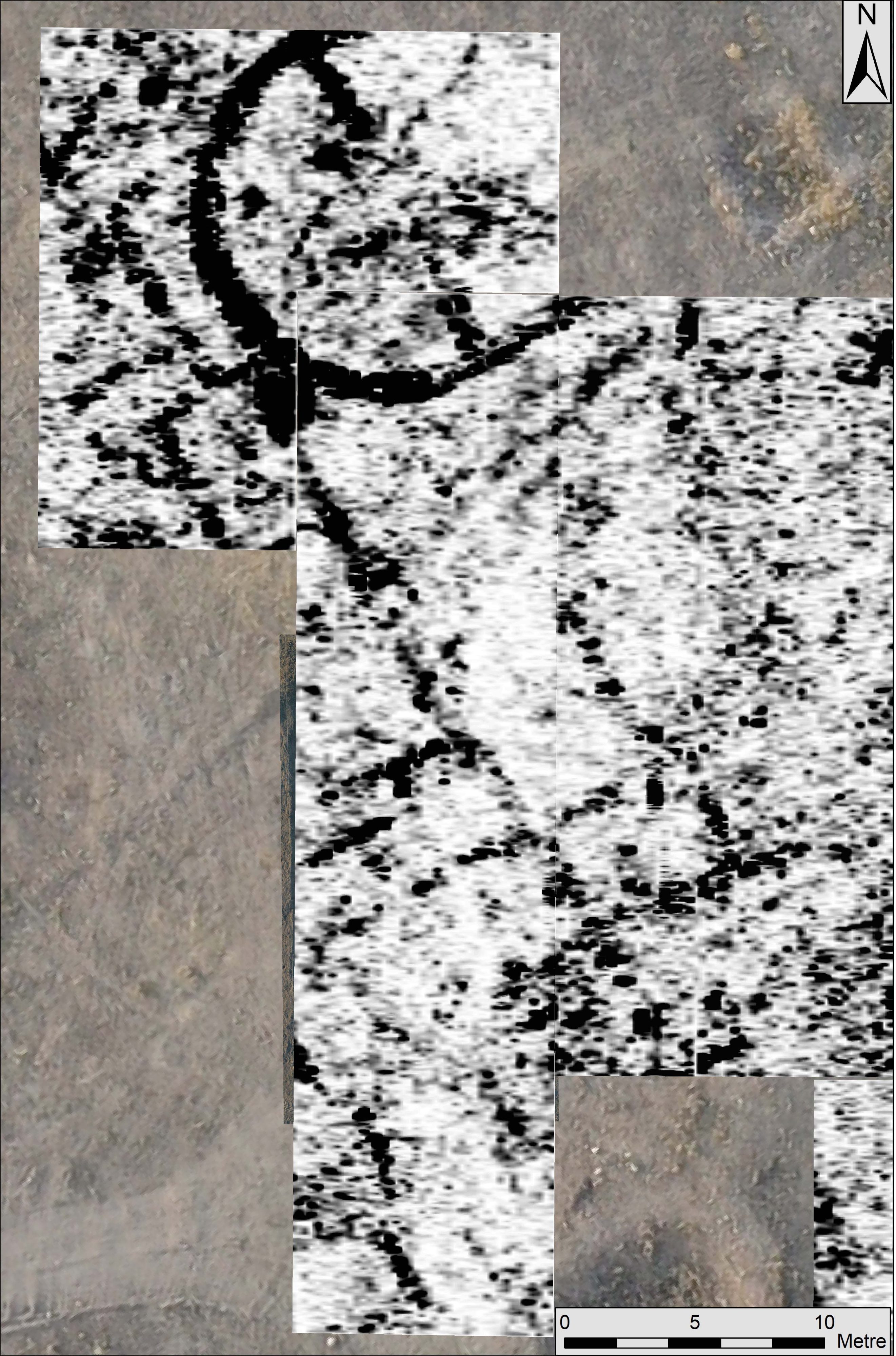
In the second season of archaeological excavation of the hoyuk (mound), geophysical surveys were planned to decide on excavation areas. Using the GPR survey was aimed to obtain the form of the structures at the mound. GSSI UtilityScan System 350Hs antenna was used for the survey with the focus of 5,00 meter depth from the surface. The survey areas have been chosen with the purpose of understanding the plan of the hoyuk (mound) based on the findings from the archaeological surveys.
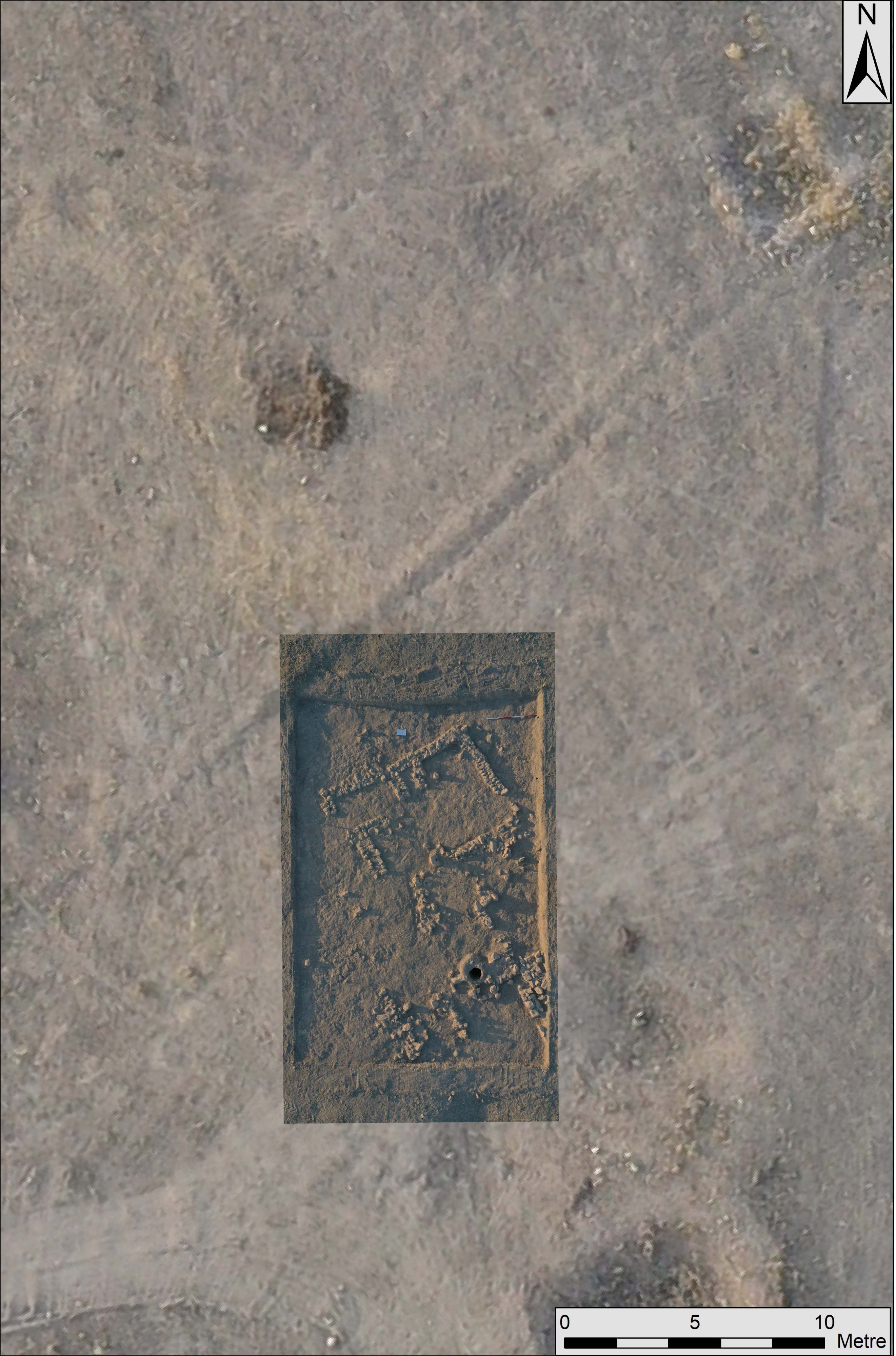
Following the GPR survey and data processing resulted a 3-D geophysical model of the buried structures. Depth slices from various depth intervals were extracted from the 3-D geophysical model to see different structures attributed to different eras and civilizations. The depth slices were overlapped on the georeferentiated aerial photo and then used for selecting the excavation areas. After the first area was excavated approximately 0,50 meters, the revealed structures were compared with the corresponding depth slices of the GPR survey, and it has been noticed that the geophysical results are fitted excellently. Therefore, future excavations planned for next year will be guided by GPR results and the survey will be extended for the rest of the mound.
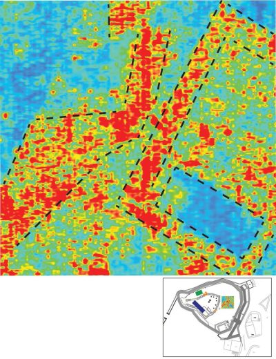
GPR (Ground Penetrating Radar) Survey at Notion
Abstract
17th International Conference on Ground Penetrating Radar (GPR 2018), Switzerland
Yigit, F., Tucker, G., Ozcelik, S., 2018
In June 2017, we conducted a GPR (Ground Penetrating Radar) survey at the ancient city of Notion as part of the Notion Archaeological Survey. In prior seasons, magnetic gradiometry survey revealed much of the form and fabric of the city, and this season we decided to complement these results with GPR investigations in the hope of obtaining more detailed 3-dimensional results in targeted areas of the site.
The survey was undertaken with 200 and 400 MHz shielded antennae with a focus on mapping the bedrock profile as well as features within 2.5m of the ground surface. The survey areas across the site targeted places where the results could best help answer the research questions of the project and include a terrace near the city wall overlooking the valley to the north with two visible threshold blocks and two terraces to the east side of the site which prior survey has shown were likely domestic spaces. The purpose of surveying these areas was to explore the possible buried roads and houses, more precisely mapping them and identifying their depth. The collected data have been combined to produce a 3-D cube representing the features laying beneath the subsurface. From these 3-D cubes, it is possible to produce amplitude time-slices at various depths below the surface, which show the anomalies detected during the survey. The initial results of the GPR survey have been inspiring and will contribute greatly to our understanding of the site, while also forming the basis for future investigations through further survey or excavation.
Keywords: GPR, Archaeological Survey, Notion Archaeological Site
Ground Penetrating Radar As A Survey At Riva Fortress Restoration Project
Abstract
9th Congress of Balkan Geophysical Society, 2017, Türkiye
Ozcelik, S., Yigit, F., 2017.
GPR survey has been done in order to guide the restoration project at Riva Fortress which located on the shore of Black Sea, Istanbul, Beykoz district. The purpose of the survey was finding out the possible archaeological features and structures inside the fortress. The conditions of the fortress was suitable for GPR, and the prior surveys have been done with 200 MHz shielded antenna to locate the high amplitude anomalies between the surface and 10.00 meters estimated depth. After processing the data obtained from 200 MHz shielded antenna, detailed surveys have been planned with 400 MHz shielded antenna which has the estimated penetration depth around 2.50 meters. Thus, the data obtained from 400 MHz shielded antenna gives us higher resolution to define the borders and depths of structures and features more accurately. By combining the data of 2-D vertical GPR profiles’ have set in certain areas, 3-D cubes has been produced. These 3-D cubes make it possible to have time-slices for various depths. Borders and depths of features can be seen in those time-slices.
KEYWORDS: GPR, Archaeological Survey, Riva Fortress
